2024-04-08 Lectorat und Übersetzung mittels dem Übersetzungs-Werkzeug DeepL.com / Write Lectorate and translation using the translation tool DeepL.com / Write
Die Staaten Mali, Burkina Faso und Niger haben sich aufgrund militärischer Auseinandersetzungen und Uneinigkeit der politischen Akteure mit Frankreich und der EU aus der Westafrikanischen Union zurückgezogen. Die Militärs werden derzeit von der RUS unterstützt.
The states of Mali, Burkina Faso and Niger have withdrawn from the West African Union due to military disputes and disagreements between the political players with France and the EU. The military is currently being supported by the RUS.
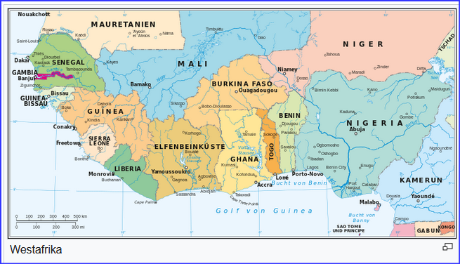
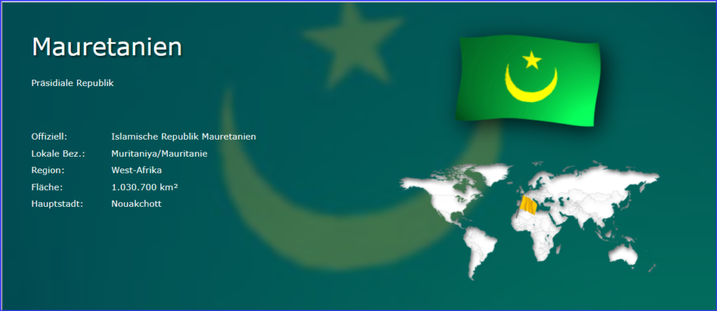
Mauretanien ist ein Land in West-Afrika und grenzt an den Atlantik im Westen und die Sahara im Osten. Das Land hat eine Gesamtfläche von 1.030.700 km² und eine Küstenlänge von insgesamt 754 km. Diese Landmasse entspricht ungefähr 2,9 Mal der Größe Deutschlands. Mauretanien ist damit eines der größten Länder in Afrika und das 29st-größte Land der Welt. Mit 4,7 Einwohnern pro km² gehört es zu den am dünnsten besiedelten Ländern der Erde. Mehr als die Hälfte der Einwohner (57%) wohnt innerhalb der Städte. Jeder fünfte Einwohner lebt in Nouakchott.
Mauritania is a country in West Africa, bordering the Atlantic Ocean to the west and the Sahara Desert to the east. The country has a total area of 1,030,700 km² and a coastline totalling 754 km. This land mass is approximately 2.9 times the size of Germany. This makes Mauritania one of the largest countries in Africa and the 29th largest country in the world. With 4.7 inhabitants per square kilometre, it is one of the most sparsely populated countries in the world. More than half of the population (57%) lives within the cities. Every fifth inhabitant lives in Nouakchott.
Mauretanien liegt vergleichsweise niedrig auf einer Höhe von durchschnittlich 276 Metern über dem Meeresspiegel. Die höchste Erhebung des Landes (Kediet Ijill) liegt auf 915 Metern Höhe. Zum Land gehören rund 10 Inseln. Direkte Landesgrenzen bestehen zu den 4 Nachbarstaaten Algerien, Mali, Senegal und Westsahara. Die Entfernung zwischen Berlin und der Hauptstadt Nouakchott beträgt ungefähr 4.610 km.
Mauritania is comparatively low at an average altitude of 276 metres above sea level. The highest point in the country (Kediet Ijill) is 915 metres above sea level. Around 10 islands belong to the country. There are direct borders with the 4 neighbouring countries Algeria, Mali, Senegal and Western Sahara. The distance between Berlin and the capital Nouakchott is approximately 4,610 kilometres.
Die wichtigsten Städte
The most important towns
Die genannten Einwohnerzahlen beziehen sich auf das eigentliche Stadtgebiet, nicht auf Ballungsräume.
The population figures given refer to the actual urban area, not to conurbations.